Lenovo laptop supports drone-based wildfire mapping
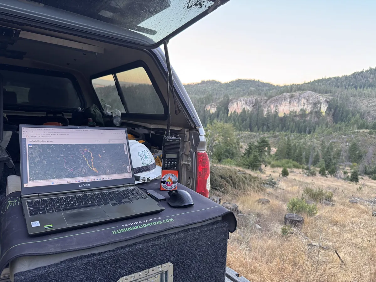
A US nonprofit organization creates standardized maps from thermal drone imagery so that nighttime wildfire data can reach firefighters by morning. The system is being developed and tested on Lenovo Legion laptops.
- The system creates standardized wildfire maps from thermal drone data.
- During the 2026 fire season, the median time from upload to approval was 18 minutes.
- The Legion Pro 7i has an Intel Core Ultra 9 processor and an NVIDIA GeForce RTX 5070 Ti graphics card.
- On October 21, the archive contained 894 files covering 79 nights at 12 wildfire incidents.
Turning drone data into a usable map
The UAS Wildland Fire Collaborative is developing a system that converts data from thermal-imaging drones flown over wildfires into maps with a standardized format. The organization was founded by a professional who has worked as a wildland firefighter since 2012 and has piloted drones at fire incidents since 2019. The nonprofit was established in May 2026 to make the solution available to other pilots and firefighting organizations free of charge.
The pilot uploads the data from the nighttime flight, and the processing workflow identifies the files, associates them with the relevant wildfire, and then creates the maps. The system produces topographic and aerial map sheets, Google Earth files, GIS-compatible datasets, and a daily infrared activity log. The maps mark the heat perimeter detected by the drone, individual hotspots, areas of intense heat, and possible heat signatures that may require further inspection.
Before finalization, the pilot reviews and approves the results. According to Lenovo, during the 2026 fire season, the median time from upload to approval, including the pilot's review, was 18 minutes.
The role of Legion machines in processing
The system was originally developed on a Lenovo Legion 5 laptop. The machine was used to test the processing workflow, map templates tailored to organizations, and software modifications. Its NVIDIA graphics card played an important role in running Agisoft Metashape and ArcGIS Pro. The former assembles larger heat maps from drone imagery, while the latter is needed for GIS analysis and map development.
A single flight can produce hundreds of thermal images. Lenovo cites an October flight over West Fork Evans Creek as an example: a map was created from its 195 thermal photos in the cloud-based stitching system approximately six minutes after upload. The cloud now handles a significant portion of users' processing work, but the local machine remains important for processing their own flights, software development, and large LiDAR datasets.
After the original Legion's graphics card failed, one larger ArcGIS Pro project opened in approximately two and a half minutes using a backup graphics controller. Lenovo subsequently provided a Legion Pro 7i laptop with an Intel Core Ultra 9 processor and an NVIDIA GeForce RTX 5070 Ti graphics card.
The maps also found hidden heat sources in the field
At the East Evans Creek fire in Jackson County, Oregon, in July 2026, thermal images showed heat outside the official daily fire perimeter. Over three weeks, the Collaborative produced 37 map series on 15 nights for the incident. The busiest map documented 3327 individual heat sources. The maps also tracked how deeply firefighters had to work inside the fire area during mop-up operations. The mapped strip expanded from 100 feet to 400 feet.
A survey at Woodrat Mountain provided another example of the value of weak heat signatures. The final thermal survey on August 19 identified only five possible heat sources. The following night, glowing embers were found at the bottom of a hollow stump at the site, along with faint heat deep inside another marked location. In every case, the final interpretation is left to personnel working in the field.
A growing shared resource for firefighting organizations
According to Lenovo, on October 21, 2026, the Collaborative's public archive contained 894 files. They represented maps delivered over 79 nights at 12 wildfire incidents. The system was used by the Oregon Department of Forestry, its South Cascade District, Hummingbird Drones, and Rogue Reconnaissance pilots. It also processed data from state forestry personnel's crewed aircraft.
The Oregon Department of Forestry's involvement also shaped how the maps are presented. Heat observed by drones appears in pink, while data from other sources is shown in red, allowing map users to quickly identify the origin of the information. The organization also provided a letter of support outlining the potential value of standardized UAS data processing.
For now, the Collaborative can measure the number of maps delivered, the wildfires supported, and processing speed. There is not yet reliable data on how many labor hours the system has saved or how it has specifically changed operational decisions. According to Lenovo, the Legion Pro 7i could help accelerate local development and mapping workflows and support the development of new tools.